AN AFRICAN AMERICAN AND NATIVE AMERICAN HERITAGE TRAIL
Honoring Cuff Slocum, Paul Cuffe, Michael Wainer and their Families
From the 1740s to 1817, the Westport/Dartmouth/New Bedford area was home to three remarkable, industrious, related families of color, of African and Native heritage. These families included successful farmers, shipbuilders, coastal and international traders, and promoters of African development. In an era when slavery was still prevalent in both the South and North and Native Americans were being driven from their homelands, these families provided living testimony to the potentials of the human spirit across all peoples.

Cuff Slocum, an African slave, and the patriarch of the families, arrived in New England on a slave ship in the 1720s, bought his freedom from John Slocum in the 1740s, married a Native American woman, Ruth Moses, in 1747, raised a family of 10 children on Cuttyhunk Island, and bought a 120-acre farm in Westport in 1766 that passed to his widow and two younger sons when he died in 1772.
![]()
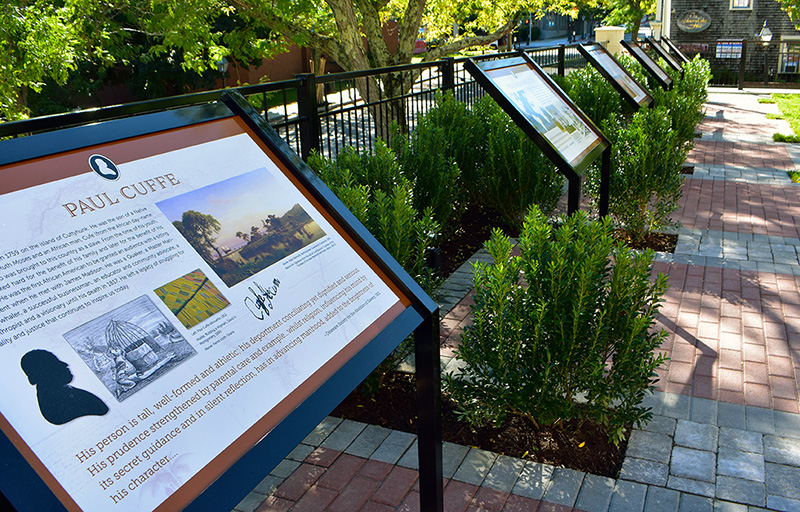
Paul Cuffe, Cuff and Ruth’s youngest son, was the most prominent and influential member of the family and the one best known and celebrated in modern times. He took to the sea soon after his father’s death, ran British naval blockades to supply goods to Nantucket during the Revolutionary War, petitioned for the right of black citizens to vote in Massachusetts, married Alice Abel Pequit, a widowed Native American woman in 1783, built ships and engaged in coastal trade and whaling from his Westport River wharf in the 1790s, set up a free, integrated school nearby, became a member of the Westport Friends Meeting in 1808 and from 1811 to 1816 gained international prominence through his efforts to assist former slaves settled by the British in their colony of Sierra Leone by helping them produce commodities for international commerce. READ MORE
SITES ON THE HERITAGE TRAIL
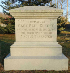
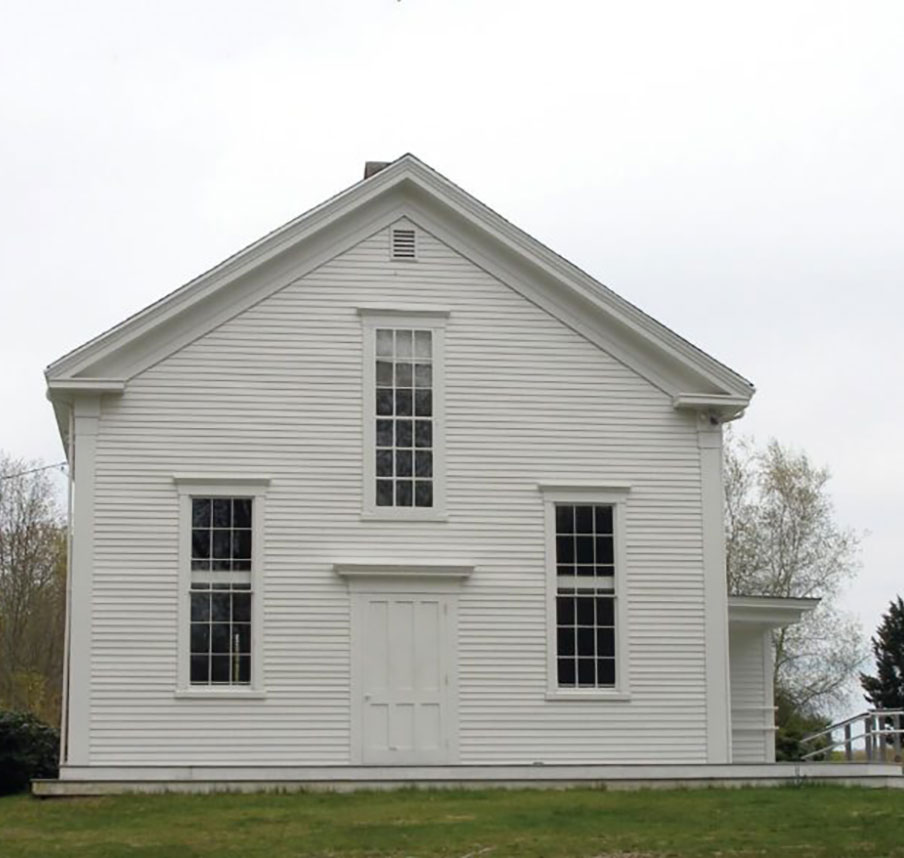
1. The Captain Paul Cuffe Memorial and Friends Meeting House at 930 Main Road in Westport’s Central Village. A monument to honor Paul Cuffe, an esteemed member of this Quaker Meeting, was placed in the yard of the Friends Meeting House in 1913 by his great-grandson, Horatio P. Howard. Paul Cuffe was a member of the committee responsible for constructing this Meeting House in 1814 and contributed a major share of the total cost.
-
- Monument located at Westport Quaker Meeting House

-
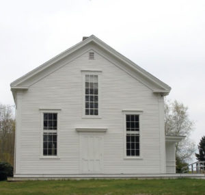
- Westport Quaker Meeting house
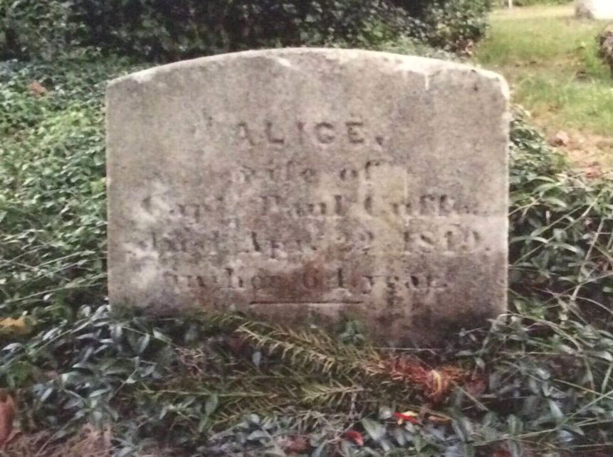
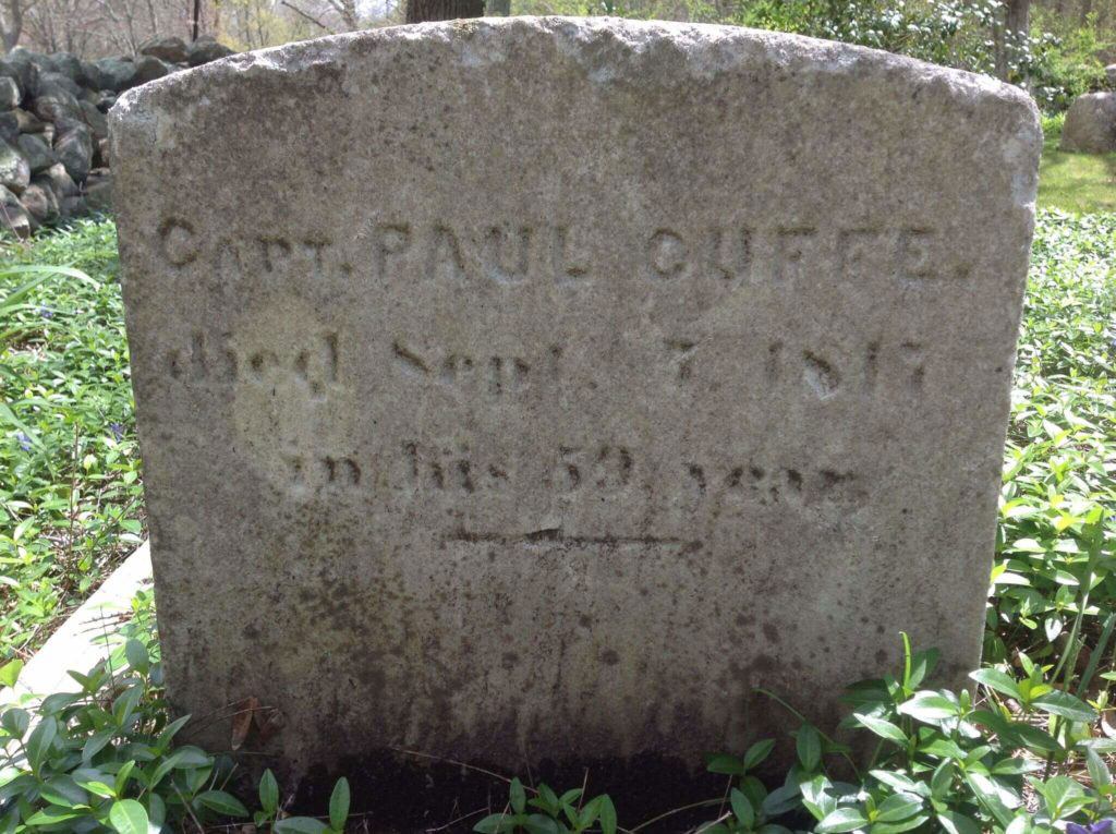
2. Cuffe Grave Site. 930 Main Road, Westport. Gravestones commemorating Paul Cuffe (1759-1817) and his wife Alice Abel Cuffe (1755-1819) are located in the cemetery behind the Friends Meeting House.
-

- Grave of Alice Cuffe
-

- Grave of Paul Cuffe
3. Cuffe Windmill. 1853 Main Road, Westport. The site of a windmill at Westport Point owned by Paul Cuffe, Washington Davis, and Samuel Hicks. This site on the crest of a hill was a favorable location for a wind-powered mill to grind grain for the local citizens. No structure remains.
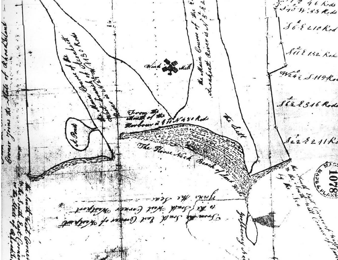
This essentially involved a lease of an existing windmill at Acoaxet (Westport) Point by Paul Cuffe, Washington Davis, and Samuel Hicks, from the owners, Philip and Humphrey Macomber for $120 for as long as they should continue to operate the mill. The mill was located a little north of Charles Macomber’s dwelling house. According to the report on the so-called Benjamin Hicks house at 1865 Main Road, Westport Point submitted to the Mass. Historical Commission, this house was owned by and resided in by Charles Macomber from 1794 to 1805. Thus the mill was located on the property on the west side of Main Road, north of Cape Bial Lane, now 1853 Main Road. There is no record of the later disposition of this windmill by Cuffe, Davis, and Hicks, or for how long they may have operated it, or when it might have been dismantled.
4. Cuffe Wharf. 1430-1436 Drift Road, Westport. At the end of a private drive, the wharf was on the West bank of the East Branch of the Acoaxet (later Westport) River. Paul Cuffe purchased a lot of 0.22 acres on the riverfront in 1789, where he built and docked most of his ships
Paul Cuffe purchased his first property on the west bank of the Westport River on March 19, 1789, from Isaac Sowle for four pounds, 18 shillings and 5 pence. The property, carved out of the southeast corner of Isaac Sowle’s homestead, contained 35 square rods (0.22 acres), and was bounded on the east by the East Branch of the Westport River, on the south by land of Joseph Sowle, a distance of 8 3/4 rods, thence north 4 rods and thence east, in a line parallel to the south boundary, to the river. READ MORE
5. Cuffe Homestead. 1430-1436 Drift Road, Westport. In 1813 Paul Cuffe purchased 4 additional acres of land around his wharf and residence from David Soule. He had already constructed a substantial house in 1797 on the .22 acres he bought in 1789. This entire property referred to as his homestead in his will was allocated to his wife and children upon his death in 1817. No structures from that time remain. His free integrated school was also established nearby in 1797.
Where was the Cuffe Family Residence?
Paul Cuffe acquired many properties in his lifetime, but the deeds for those properties do not indicate where he resided – no homestead property was acknowledged until his death. A deed by Timothy Russell in 1783 indicated that Paul Cuffe, in the year of his marriage, was living in an Indian style house on the 1/2 acre which was part of Timothy Russells’ property. Six years later Cuffe purchased the small property of 35 square rods (0.22 acres) on the banks of the East Branch of the Westport River in 1789 where he established his wharf and boatyard. There is strong indirect evidence from the 1790 and 1810 censuses that he and his family were residing in this area near his wharf. The 1790 census listings appear to record households in a sequence reflecting neighbors as though the census-taker was working his way along a road, such as the Driftway (Drift Road), near which this Cuffe property was located. The names of heads of households preceding the entry for Paul Cuffe (actually recorded as Paul Cuff in the census) and his family of 7 are Lemuel Sowle, Joseph Sowle, Isaac Sowle and David Sowle. READ MORE
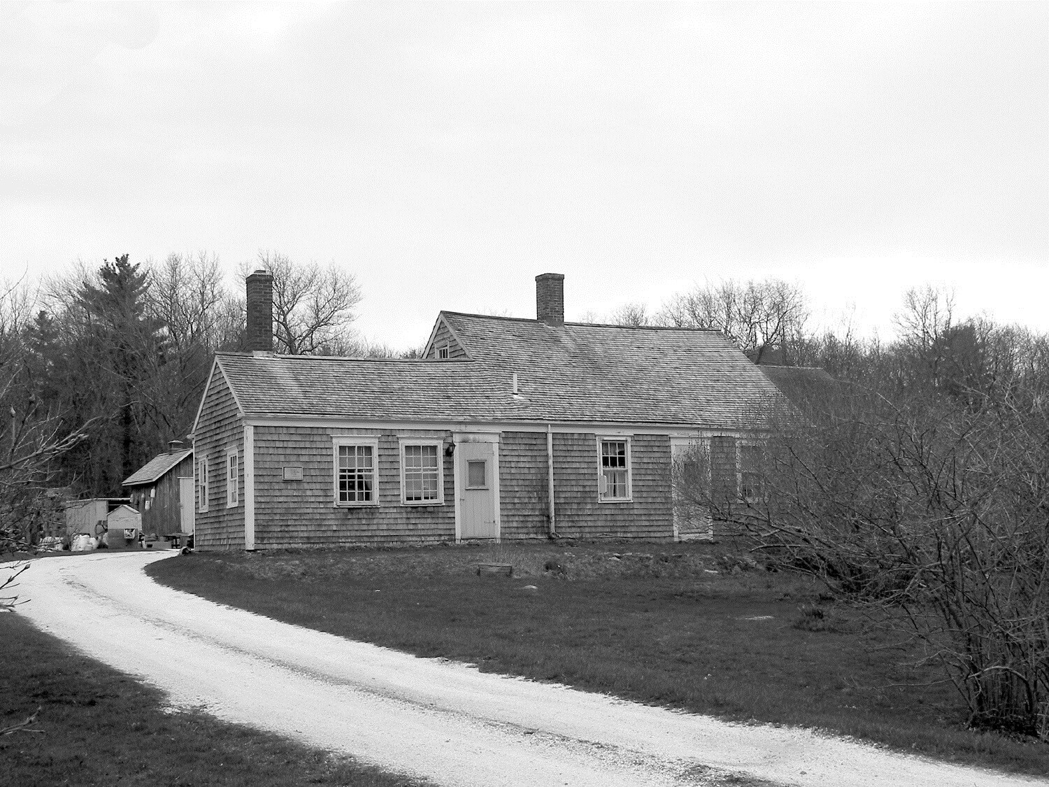
6. Wainer Homestead. 1511 and 1504 Drift Road. Westport. The Wainer Homestead straddled Drift Road running from the riverfront to what is now Route 88. The original Eddy house, shown in the picture, was on 1504, and the farm fields ran to the west of 1507, parts of which remain in Wainer descendants’ hands today. Paul Cuffe purchased this 100-acre property from Ebenezer Eddy in 1799 and sold it to Michael and Mary Wainer, his brother-in-law and sister, in 1800.
7. Cadman White Handy House. 202 Hix Bridge Road, Westport. In the 19th century, this was the residence of Dr. James Handy. The records and accounts of Dr. Handy have survived, recording the treatment that he provided for Paul Cuffe and other members of his family. Dr. Handy visited Paul Cuffe regularly during the last months of his life in 1817. The Handy House is now owned by the Westport Historical Society and is open to the public during the summer.

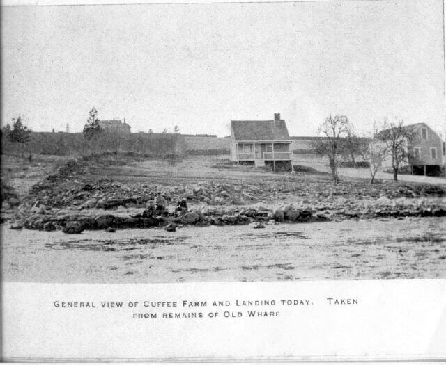
8. Cuff Slocum Farm. 761 Old County Road. Westport. Cuff Slocum and his wife Ruth purchased a 120-acre farm at this location in 1766 and moved their family of ten children here from Cuttyhunk in the spring of 1767. The farm remained in his family’s hands for fifty years. A house and barns that were on the farm when they purchased it have since been replaced. The western half of the farm was inherited by Paul Cuffe and then his son, Paul Cuffe, Jr. A new solar farm, the Cuff Slocum Community Solar Farm, has recently been established on part of this property and named in honor of Cuff Slocum. It is on private property and not accessible to the public.
The farm that Cuff and Ruth Slocum purchased from David Brownell in 1766 for 650 Spanish milled silver dollars has been mistakenly described in most of the books about Paul Cuffe. The actual story, as we have been able to determine and verify is as follows:
- The farm was located along the south side of what was referred to in the deeds as “a country road” but is now known as Old County Road, a well-traveled route in early times from New Bedford to Newport. READ MORE
9. Cuffe-Howard Cemetery. 665 Old Westport Road, Corner of Fisher and Old Westport Road, Dartmouth. This cemetery, on high ground at the northeast corner of the Cuff Slocum farm, is believed to be a burial site for many of the Slocum and Cuffe family members. Following both the Quaker and Native-American traditions, there are no marked stones, only unmarked fieldstones. The cemetery is named for Naomi Cuffe Howard, daughter of Paul and Alice Cuffe and wife of Peter Howard, who died in 1810.
10. Wainer Early Homesite. 1228 Russell’s Mills Road, Dartmouth. Home and business site of Michael and Mary Wainer (1776-1792). This is now the site of Davoll’s Store. Michael Wainer (c. 1748-1815) married Mary Slocum Cuffe (1753-1804), daughter of Cuff and Ruth Slocum, in 1772. They purchased this property from Giles Russell in 1776, resided here and probably operated a leather tannery and shoe-making business until 1792 when they sold the property to William Howland a merchant from New Bedford.
In 1776, four years after his marriage to Ruth Slocum, Michael Wainer, alias Michael Quabin, a Mustee man of Dartmouth, purchased a property in between three intersecting ways at the heart of the village of Russell’s Mills. READ MORE
11. The Captain Paul Cuffe Park at the New Bedford Whaling Museum. 18 Johnny Cake Hill. The Captain Paul Cuffe Park adjacent to the Museum building is a memorial park commemorating his life and legacy. In 2018 the New Bedford Whaling Museum opened an exhibition devoted to the life, times, and legacy of Captain Paul Cuffe.
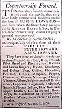
Cuff & Howard’s store, founded in 1809, sold imported goods from the West Indies. It was located on the west side of Water Street in an area that is now part of the Whaling Museum complex.